A silent landscape once covered in rivers, forests and life has been found locked beneath Antarctica’s vast, featureless ice sheet.
What at first looked like just another stretch of white on satellite images has turned out to be a hidden landscape, sealed off from sunlight and weather since long before humans existed. Now scientists say this buried terrain is reshaping how we think about Antarctica’s past — and its future.
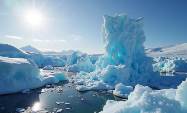
A hidden landscape beneath the ice
Using a mix of satellite data, ice-penetrating radar and careful computer modelling, researchers have mapped a fossil landscape almost the size of a small country beneath East Antarctica. It lies roughly two kilometres below the surface of the ice, preserved like a natural time capsule.
This “lost world” is thought to date back at least 34 million years, to a time when Antarctica was not a frozen desert but a milder, vegetated continent. Back then, the region likely hosted river valleys, wetlands and possibly dense forests, before a dramatic shift in global climate covered the land under ice.
The buried terrain shows carved river valleys, rolling hills and ancient basins, all preserved beneath a stable cap of ice.
Scientists describe the landscape as hauntingly familiar: it looks more like parts of modern-day Wales or Scotland than the harsh, white emptiness usually associated with Antarctica.
How scientists found a world they cannot see
Reading the ice from space
Researchers began by examining subtle variations in the height of the ice sheet using satellite altimetry. Small changes in surface elevation can hint at the shape of rock and sediment far below. Where the ice dips slightly, there may be valleys or basins. Where it rises, hidden ridges or plateaus often sit beneath.
These clues pointed to something unusual: a patterned set of depressions and ridges that did not match typical ice flow features. That pattern hinted at a pre-existing landscape, shaped by rivers long before the ice arrived.
Peering below with radar
To confirm the satellite evidence, the team turned to aerogeophysical surveys. Aircraft equipped with ice-penetrating radar flew back-and-forth grids across the region, sending radio waves through the ice and measuring the signals that bounced back from the bedrock below.
By combining thousands of radar traces, researchers built a 3D map of the buried land surface. The resulting picture revealed valley networks, tributaries and lowlands that clearly formed through erosion by flowing water, not by ice itself.
➡️ After 220 years of investigation, science finally unmasks the identity of a legendary criminal
➡️ The physiotherapist’s trick for relaxing your back in one minute without equipment
➡️ How the brain reacts differently to visible versus invisible progress
➡️ “At 63, my feet felt unstable on uneven ground”: the sensory decline involved
Ice-penetrating radar acts like an X-ray for the continent, revealing ancient rivers and plains carved long before Antarctica froze.
A snapshot from a warmer Antarctic past
The age of this landscape is tied to a turning point in Earth’s climate: the Eocene–Oligocene transition, around 34 million years ago. Before that, Antarctica was warmer and supported vegetation. Geological evidence from coastal rocks suggests forests of beech and conifer once grew there, with diverse plant and animal life.
Then global temperatures dropped. Atmospheric carbon dioxide fell. Ocean currents shifted, isolating Antarctica and triggering the build-up of continental ice sheets.
The newly mapped landscape appears to have been rapidly covered by ice during this transition, then left largely untouched. Some parts may not have seen liquid water or open air since the first massive ice sheets formed.
- Before 34 million years ago: Ice-free terrain, active rivers, vegetation, milder climate.
- Around 34 million years ago: Global cooling, growth of continental ice sheets, landscape buried.
- Since then: Thick ice preserves the terrain, shielding it from erosion and weathering.
What this tells us about future sea-level rise
The discovery is not just a geological curiosity. It helps researchers understand how and when the Antarctic ice sheet formed, and how stable it might be under future warming.
If the buried landscape has remained mostly unchanged for tens of millions of years, that hints at long-term stability in parts of East Antarctica. This region is currently considered one of the more resistant sections of the ice sheet.
Yet stability in the past does not guarantee safety in the future. Today’s rate of warming, fuelled by human emissions, is far faster than the natural cycles that shaped Antarctica’s history.
The fossil terrain offers a baseline: it shows what Antarctica looked like the last time Earth was significantly warmer, before the ice took over.
By feeding the mapped landscape into ice-sheet models, scientists can test how the ice might react as temperatures rise. Steeper buried valleys can channel warm water and increase ice flow. Smooth plains can act as brakes. Understanding this hidden topography is crucial for predicting how quickly ice might retreat and how much sea levels may rise.
Could anything still be alive down there?
Although the terrain itself is now buried rock, the overlying ice may host unique ecosystems. Elsewhere in Antarctica, researchers have drilled through the ice and found subglacial lakes and water networks containing microbes that survive in total darkness, under extreme pressure and with almost no nutrients.
No one has drilled directly into this newly mapped region, so any life beneath remains unknown. But its long isolation makes it a tempting target for future clean-access missions.
The challenge of reaching a sealed landscape
Accessing this lost world is technically and ethically complex. Drilling through two kilometres of ice without contaminating any potential subglacial water requires strict protocols. Past projects have shown how easily drilling fluids or surface microbes can compromise pristine environments.
Any future mission would likely involve:
- Hot-water drills using ultra-clean, filtered water
- Closed-circuit systems to capture all fluids
- Careful screening for biological contamination
- Remote instruments to sample rock and ice without human contact
The scientific payoff could be significant: new insights into extreme life, ancient climate signals stored in deep ice, and detailed rock samples from a time when Antarctica was green.
How this landscape compares with other hidden worlds
Antarctica holds many buried secrets beneath its ice. Scientists have already mapped vast subglacial lakes such as Lake Vostok, sprawling canyons deeper than the Grand Canyon, and mountain ranges like the Gamburtsev, entirely hidden from view.
What makes this newly revealed landscape stand out is its age and preservation. It appears not as a chaotic jumble of glacial scars, but as a relatively orderly river system, frozen in place almost as it was left in the Eocene.
This is not just rough bedrock. It is a fossilised environment, a preserved record of how Antarctica once looked and functioned.
Comparing this terrain with other subglacial features helps piece together how the ice sheet grew: where it first thickened, which valleys were flooded or eroded by ice streams, and which pockets stayed sheltered.
Key terms behind the science
A few concepts help make sense of the research:
- Ice-penetrating radar: A technique that sends radio waves through ice. Different materials reflect the signal differently, allowing scientists to map layers and bedrock.
- Subglacial landscape: Any terrain located beneath a glacier or ice sheet, including lakes, rivers, hills and plains.
- Eocene–Oligocene transition: A major climate shift around 34 million years ago when Earth moved from a greenhouse state to a cooler one, allowing large ice sheets to form.
- Ice sheet model: A computer simulation used to test how ice responds to changes in temperature, snowfall or ocean conditions.
What this means for climate history and the present day
The buried Antarctic world acts like a missing chapter in Earth’s climate story. It links an ice-free, forested continent to the frozen giant we see on maps today. By studying the shapes of valleys and the thickness of overlying ice, researchers can estimate how quickly ice grew and how strongly it altered the landscape.
Modern climate change is pushing conditions in the opposite direction: from a long-standing icehouse state toward something warmer. If greenhouse gas levels continue to rise, parts of Antarctica may eventually resemble climate conditions closer to those that existed before the ice sheet formed, though on a very different timescale.
Scientists use the ancient landscape as a reference point to run “what-if” simulations. For example, they can test how much warming would be needed to thin the ice enough to reactivate old river pathways, or what sea-level rise would result if specific basins under East Antarctica became destabilised.
These scenarios inform long-term risk assessments for coastal cities worldwide, from London and New York to low-lying island nations. The frozen, unseen valleys beneath Antarctica are quietly shaping predictions about future shorelines thousands of kilometres away.